

Best App for Traveling to Canada 2026
For most travelers, the best app for traveling to Canada is not one single app but a small setup that covers arrival, navigation, weather, safety, and mobile data. Start with ArriveCAN for Advance CBSA Declaration before landing, then use Google Maps or Apple Maps for directions, Transit for city transport, WeatherCAN for official alerts, and Parks Canada or trail apps for national parks. Offline downloads are useful, especially on road trips or in mountain areas, but live data is still needed for traffic, transit changes, hotel messages, ride-hailing, weather warnings, and emergency searches after you arrive with more travel confidence.
Quick Answer: What Apps Should You Download Before Traveling to Canada?
Essential apps for traveling to Canada include ArriveCAN for Advance CBSA Declaration, Google Maps or Apple Maps for navigation, Transit for city public transport, WeatherCAN for official weather alerts, Parks Canada for national parks, and Twise eSIM setup for mobile data after landing. If you are road-tripping, add offline maps, GasBuddy, a car rental app and EV charging apps if needed. If you are hiking, add AllTrails, Avenza or other offline trail maps.
The essential Canada travel app stack
| Need | Recommended app | Why it matters |
| Customs declaration | ArriveCAN | Submit Advance CBSA Declaration before flying into participating airports. |
| Maps and offline navigation | Google Maps / Apple Maps | Plan routes, save places and download offline areas before departure. |
| City transit | Transit / local transit apps | Check buses, subway, streetcars, bikeshare and service alerts. |
| Weather alerts | WeatherCAN | Use official Canadian weather forecasts and alerts. |
| National parks | Parks Canada | Access park information, travel tips, interactive maps and offline content. |
| Hiking | AllTrails / Avenza / offline trail maps | Download trails, route notes and return paths before entering weak-signal areas. |
| Road trips | GasBuddy / car rental app / EV charging apps | Plan fuel, charging, pickup details, roadside help and long-distance stops. |
| Flights and accommodation | Airline app / hotel or booking app | Receive delay, baggage, gate, check-in and arrival messages. |
| Mobile data | Twise eSIM setup / Canada eSIM | Keep maps, transit, alerts, ride-hailing and hotel messages working after landing. |
Download before departure, not after landing
Install and sign in to important apps before your flight. Airport Wi-Fi can be crowded, verification codes may fail without roaming, and your battery may already be low after a long trip. The most important apps are the ones that involve login, payment, identity, map downloads or travel documents.
The practical rule
If an app requires account verification, a payment method, an offline download, location permissions or a booking confirmation, set it up before you fly. Your first hour in Canada should be spent moving through the airport, not trying to remember passwords.
Border and Arrival Apps: ArriveCAN, CanBorder, Airline Apps and Hotel Access
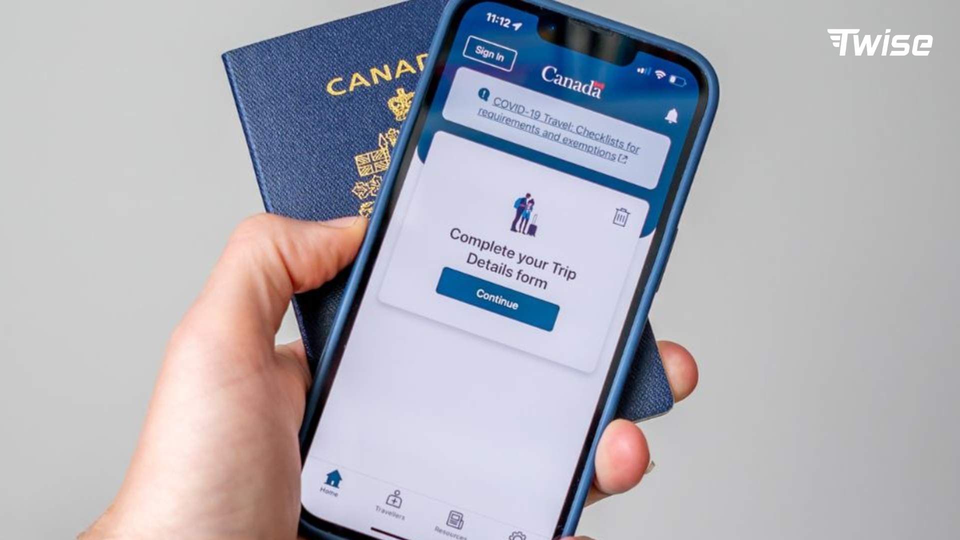
Arrival apps are not glamorous, but they reduce the most stressful part of international travel: the first 60 minutes after landing. Before you worry about restaurants or photo spots, make sure you can clear arrival, connect to data, open your hotel address and receive important notifications.
ArriveCAN for Advance CBSA Declaration
ArriveCAN is the most important official app to know before flying to Canada. The Canada Border Services Agency says travelers can use Advance Declaration in the ArriveCAN app to make customs and immigration declarations before flying into participating Canadian airports. CBSA also notes that declarations can expire if not confirmed at a kiosk or eGate within 72 hours, so the timing matters. Use it as a time-saving arrival tool, not as a replacement for checking entry requirements.
SEO note: Use “ArriveCAN is useful for Advance CBSA Declaration” instead of saying “ArriveCAN is required.” This keeps the article accurate and aligned with current official wording.
CanBorder if you are driving from the United States
If your Canada trip starts by land from the United States, CanBorder is worth considering. The official CBSA CanBorder app provides estimated wait times at select ports of entry and can help travelers choose where and when to cross. It is especially useful for road trips that include both the United States and Canada.
Airline app for flight and baggage changes
Download your airline app before departure and keep notifications on. Gate changes, delay alerts, boarding passes, baggage carousel updates and seat changes often appear in the airline app faster than they appear on airport screens. This is especially useful when you have a connection in Vancouver, Toronto, Calgary or Montreal.
Hotel or booking app for arrival messages
Your hotel or booking app is part of your arrival setup. Save your reservation, full address, check-in time, door code, late-arrival instructions and airport transfer details offline. If your flight is delayed, a live data connection helps you message the property before reception closes or before a driver leaves.
First 60 minutes in Canada checklist
- Open or confirm your Advance CBSA Declaration if you used ArriveCAN.
- Connect your eSIM or airport Wi-Fi as soon as possible.
- Check airline notifications for baggage, gate or delay updates.
- Message your hotel or host if arrival time has changed.
- Check WeatherCAN before leaving the airport.
- Open the route to your accommodation in Google Maps or Apple Maps.
- Choose transit, ride-hailing, shuttle or car rental based on time and weather.
- Notify family or travel companions that you have arrived.
Maps and Navigation Apps for Canada
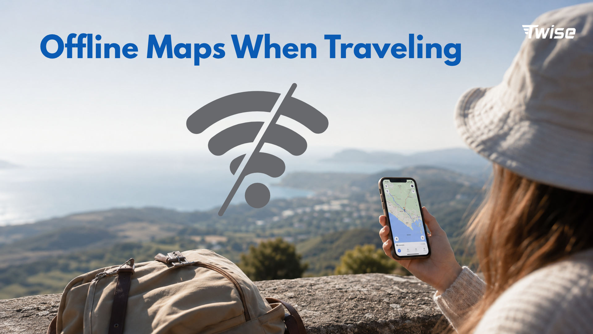
For most visitors, the most used app for traveling to Canada will be a map app. Use it for airport-to-hotel navigation, restaurant discovery, walking directions, transit planning, road trips, parking, fuel stops and saved places. The key is to combine offline preparation with live updates.
Google Maps for general navigation
Google Maps is the strongest all-around option for first-time Canada travelers because it combines navigation, place search, reviews, restaurant discovery, public transport routes and offline map downloads. Google support explains that users can manage offline maps and update downloaded areas before they expire, which makes it useful for arrival cities and road-trip corridors.
Apple Maps for iPhone users
Apple Maps can work well for iPhone-first travelers, especially if you prefer Apple’s interface and ecosystem. Apple support explains that users can download maps for offline use on iPhone where the feature is available. Even if Apple Maps is your daily app, keep Google Maps as a backup for restaurant discovery, reviews and cross-platform sharing.
Offline maps before road trips
Download more than the city center. For a Canada trip, useful offline areas include the airport, hotel neighborhood, downtown zones, train or bus stations, national park towns, highway corridors and the route back to your accommodation. This matters because parts of Canada have long distances between towns and signal can weaken outside major urban areas.
What offline maps cannot replace
Offline maps are a safety net, not full connectivity. They help when signal drops, but they do not fully replace live traffic, rerouting, road closures, current business hours, ride-hailing, hotel messages, transit disruptions or weather alerts. For a smoother trip, pair offline maps with mobile data rather than choosing one or the other.
Featured snippet target: Google Maps is the most useful map app for first-time Canada travelers because it supports navigation, place search, reviews and offline map downloads. Download your arrival city, hotel area and road-trip regions before departure, but keep mobile data available for live traffic, weather, transit and hotel messages.
Transit Apps for Canadian Cities
Public transport in Canada is city-specific. Google Maps can often get you from A to B, but local transit tools are better for real-time service alerts, fare systems, route changes and nearby departures. This is especially useful if you are visiting Toronto, Vancouver, Montreal, Ottawa or Calgary without renting a car.
Transit App for buses, subway and local transport
Transit is one of the most useful city apps for Canada because it shows nearby buses, subways, bikeshare and other transport options as soon as users open the app. Its official region list includes many Canadian cities and regions, which makes it useful when you do not know the local agency name or route number.
Toronto: TTC, GO Transit and PRESTO
Toronto-area travelers may need more than one tool. Use a map app or Transit for routing, then check local information for TTC subway, streetcar and bus service, GO Transit regional routes and PRESTO payment. If your stay includes downtown Toronto plus Niagara Falls, Mississauga, Markham or other Greater Toronto Area destinations, regional transit planning becomes more important.
Vancouver: TransLink
Metro Vancouver travelers should recognize TransLink as the public transport system behind SkyTrain, buses, SeaBus and West Coast Express. TransLink’s schedules and maps page highlights bus schedules, SkyTrain, SeaBus, West Coast Express and transit alerts. Use Transit or Google Maps for quick routing, then check TransLink for official service details.
Montréal and Québec
In Montréal and Québec, expect French-language place names, station names and local transport references. Google Maps, Apple Maps and Transit can help with routing, while local transit information is useful for schedules, fares and service disruptions. Translation apps are not essential for every traveler, but they can help with menus, signs and customer-service situations in French-speaking areas.
When Google Maps is enough
For a short city stay with simple routes, Google Maps may be enough. For daily commuting, airport transfers, event nights, peak-hour travel or routes with multiple agencies, add Transit or the local transit app. The more your plan depends on exact arrival times, the more valuable real-time transit data becomes.
Weather and Safety Apps for Canada
Weather in Canada is not decorative travel information. It can affect flights, ferries, driving, hiking, clothing, mobile battery life and whether an outdoor plan is safe. A sunny forecast in one city does not tell you enough about mountain weather, wildfire smoke, winter storms or sudden temperature drops.
WeatherCAN for official forecasts and alerts
WeatherCAN is the official weather app from Environment and Climate Change Canada. Canada.ca describes WeatherCAN as Canada’s official weather source and says it makes ECCC forecasts and alerts available on mobile devices. For travelers, this makes WeatherCAN more suitable than relying only on a generic phone widget, especially during winter, wildfire season or mountain travel.
Why weather alerts matter for travelers
Weather alerts can change travel decisions. Snow and ice can delay flights and slow airport transfers. Heavy rain can affect hiking and driving visibility. Wind can disrupt ferries. Wildfire smoke can affect outdoor plans. Mountain weather can change quickly even when the city forecast looks mild. Keep WeatherCAN notifications on for your current location and saved destinations.
Alert Ready and emergency alert behavior
Canada also has Alert Ready, the public branding of the National Public Alerting System. Government information describes it as a system designed to deliver critical and potentially life-saving alerts through television, radio and wireless devices. Travelers should keep their phones powered, connected and able to receive location-relevant alerts when possible.
Winter trip setup
For winter travel, app setup becomes operational. Download your airline app, WeatherCAN, offline maps, transit tools and hotel details before departure. Cold weather can drain batteries faster, so carry a power bank and avoid depending on a single live app for every route. Save backup routes in case buses, trains or road conditions change.
National Parks, Hiking and Outdoor Apps
Canada’s national parks are a major reason travelers visit, but they also expose the limits of mobile coverage. Banff, Jasper, Yoho, Pacific Rim, Gros Morne and other park areas require more offline preparation than a city break. Download park information, maps and booking details before leaving strong Wi-Fi.
Parks Canada app
The Parks Canada app is the official starting point for national parks and historic sites. Parks Canada says the app includes features such as self-guided tours, travel tips, interactive maps and lists, and offline access. If your itinerary includes national parks, install it before arrival and download relevant content while you still have Wi-Fi.
AllTrails or offline trail maps
AllTrails and similar trail apps are useful for reviews, difficulty ratings, elevation profiles and route previews. However, do not rely only on crowd reviews. Check official park information, weather alerts and trail advisories before hiking. For paid or offline features, download the maps before you enter the park.
Avenza and park PDF maps for remote areas
Avenza or offline PDF maps can be useful when park maps are available in downloadable formats. This is helpful for remote areas where GPS may still show your position but live data is unavailable. Use these as a backup layer alongside official park guidance and a saved return route.
Banff, Jasper and mountain park setup
For Banff, Jasper and other mountain parks, prepare a small “wilderness mode” folder on your phone: Parks Canada, WeatherCAN, Google Maps offline, trail maps, hotel or campsite booking details, emergency contacts and power management settings. Mountain trips often fail not because travelers lack apps, but because they forget to download content before signal drops.
What to save before losing signal
- Trailhead location and parking information.
- Return route to hotel, campsite or town.
- Emergency contact and park visitor center information.
- Offline map area around the trail and nearest highway.
- Weather snapshot and alert status before starting.
- Reservation details for accommodation, shuttle or park entry if applicable.
Road Trip Apps for Canada
Canada road trips can involve long distances, changing weather and stretches where the next fuel stop or charger matters. A road-trip app stack should prioritize maps, fuel or charging, weather, roadside support and booking access.
Google Maps offline for highway corridors
Before a long drive, download the full corridor, not just the destination. For example, if you are driving from Calgary to Banff and Jasper, save Calgary, Canmore, Banff, Lake Louise, Jasper and the connecting highway areas. Offline maps reduce risk if coverage weakens or if you need to reroute to accommodation.
GasBuddy for fuel planning
GasBuddy can help travelers compare fuel prices and locate gas stations on longer routes. This is useful when driving between provinces or through less dense areas where fuel stops are not as frequent as in large cities. Do not wait until the tank is almost empty before searching.
EV charging apps if renting electric vehicles
If you rent an electric vehicle, install the charging apps that match your vehicle and route. Depending on the car and province, this may include PlugShare, ChargePoint, Tesla or a regional charging network. Check whether the rental company provides charging cards or account instructions before leaving the pickup location.

Car rental app
Your car rental app or booking confirmation is more than a receipt. It may include pickup instructions, roadside assistance, insurance documents, vehicle return details and reservation changes. Save this information offline in case you need help outside airport Wi-Fi.
Road-trip risk pattern
The biggest road-trip risk is assuming hotel Wi-Fi is enough. Offline maps help, but live mobile data is valuable between towns for road closures, weather warnings, accident rerouting, accommodation messages, fuel searches and emergency support.
Payments, Food, Ride-Hailing and Daily Convenience Apps
Daily convenience apps are not always essential, but they make travel easier once the core stack is ready. Prioritize payment access, ride-hailing, food, grocery and translation based on trip length and city.
Payment and banking apps
Before departure, make sure your bank app, card controls and transaction alerts are working. Travelers often use Wise, Revolut or their regular bank app to monitor CAD transactions and exchange rates. Add cards to Apple Pay or Google Wallet where supported, but keep a backup physical card.
Ride-hailing apps
Uber, Lyft and local taxi apps can be useful, but availability varies by city and province. Download and verify your account before departure. Ride-hailing apps need live data for booking, driver chat, pickup changes and payment confirmation.
Food and grocery apps
Food delivery and grocery apps are most useful for longer stays, late arrivals or apartment-style accommodation. They may require a Canadian address, local phone verification or supported payment method, so do not rely on them as your only dinner plan on the first night.
Translation apps
Translation apps are useful in Québec, multilingual neighborhoods and customer-service situations. Download offline language packs if available. For most travelers, translation is less critical than maps, weather, hotel access and mobile data, but it is still helpful for menus, signs and instructions.
City Mode vs Wilderness Mode: Which Apps Matter Most?
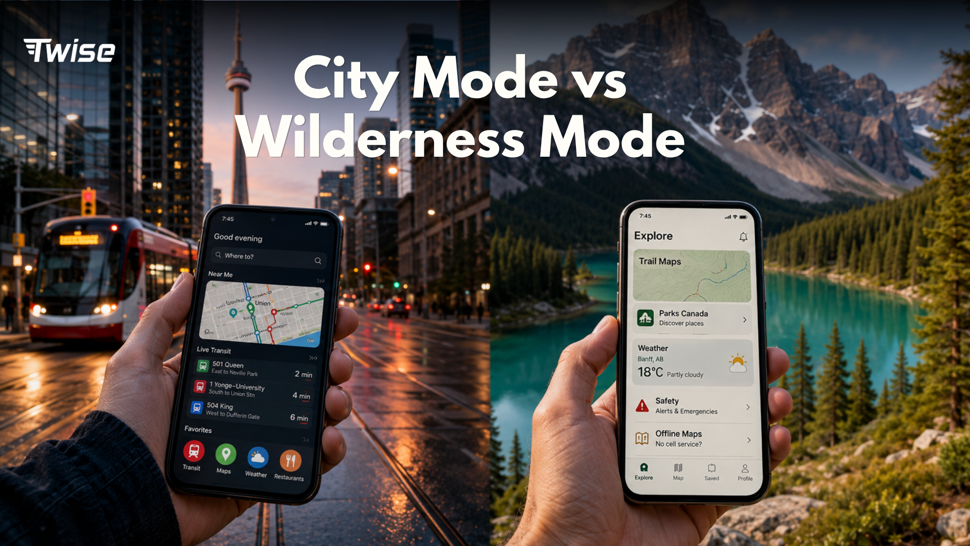
A generic app list is less useful than a mode-based setup. Canada trips often combine urban travel with outdoor areas, and each environment requires a different phone setup.
| Travel mode | Must-have apps | Best use case |
| Arrival mode | ArriveCAN, airline app, hotel app, maps, Twise eSIM | Best for the airport and first route to accommodation. |
| City mode | Google Maps, Transit/local transit, payment app, hotel app, eSIM | Best for Toronto, Vancouver, Montreal, Ottawa, Calgary and city breaks. |
| Wilderness mode | Parks Canada, WeatherCAN, offline maps, AllTrails/Avenza, power bank | Best for national parks, trails and weak-signal areas. |
| Road-trip mode | Google Maps offline, WeatherCAN, GasBuddy, car rental app, eSIM | Best for long drives and cross-province routes. |
| Winter mode | WeatherCAN, airline app, local transit alerts, road condition tools, power bank | Best for snow, ice, flight delays and colder battery conditions. |
Why one app list is not enough
A traveler spending two days in downtown Toronto does not need the same setup as someone driving through Alberta national parks in winter. Use arrival mode first, then switch to city mode, wilderness mode or road-trip mode based on your actual itinerary. This makes the article more useful than a random list of downloads.
Offline Downloads vs Mobile Data: What Works Without Internet?
Offline downloads reduce travel risk, but they are not a complete substitute for connectivity. The best setup is to download heavy content on Wi-Fi before departure, then use mobile data for live updates after landing.
| App type | Offline useful? | Live data still needed for |
| Google Maps / Apple Maps | Yes, if downloaded | Traffic, rerouting, live business info, route changes. |
| Parks Canada | Yes, for selected offline content | Latest advisories, alerts and changing conditions. |
| Trail apps | Yes, if downloaded | Updated trail reports and recent user conditions. |
| Transit apps | Limited | Real-time arrivals, detours, disruptions and service alerts. |
| WeatherCAN | Limited/no | Current forecasts, severe weather alerts and push notifications. |
| Ride-hailing | No | Booking, driver chat, pickup changes and payment. |
| Hotel/booking apps | Limited | Messages, check-in changes and transfer updates. |
| Airline apps | Limited | Delay, gate, baggage and rebooking notifications. |
Offline apps are backup, not full connectivity
Offline apps are excellent for reducing risk, saving mobile data and navigating weak-signal areas. However, they work best when paired with live data. A saved map cannot tell you that your hotel changed pickup instructions, that a bus route is delayed or that a weather alert was issued after you started your day.
When mobile data matters most
Mobile data matters most during airport arrival, route changes, transit delays, severe weather, ride-hailing, hotel messaging, emergency search, road closures and last-minute bookings. These are the moments when relying only on Wi-Fi creates stress.
Where Twise eSIM Fits: Keeping Canada Travel Apps Working
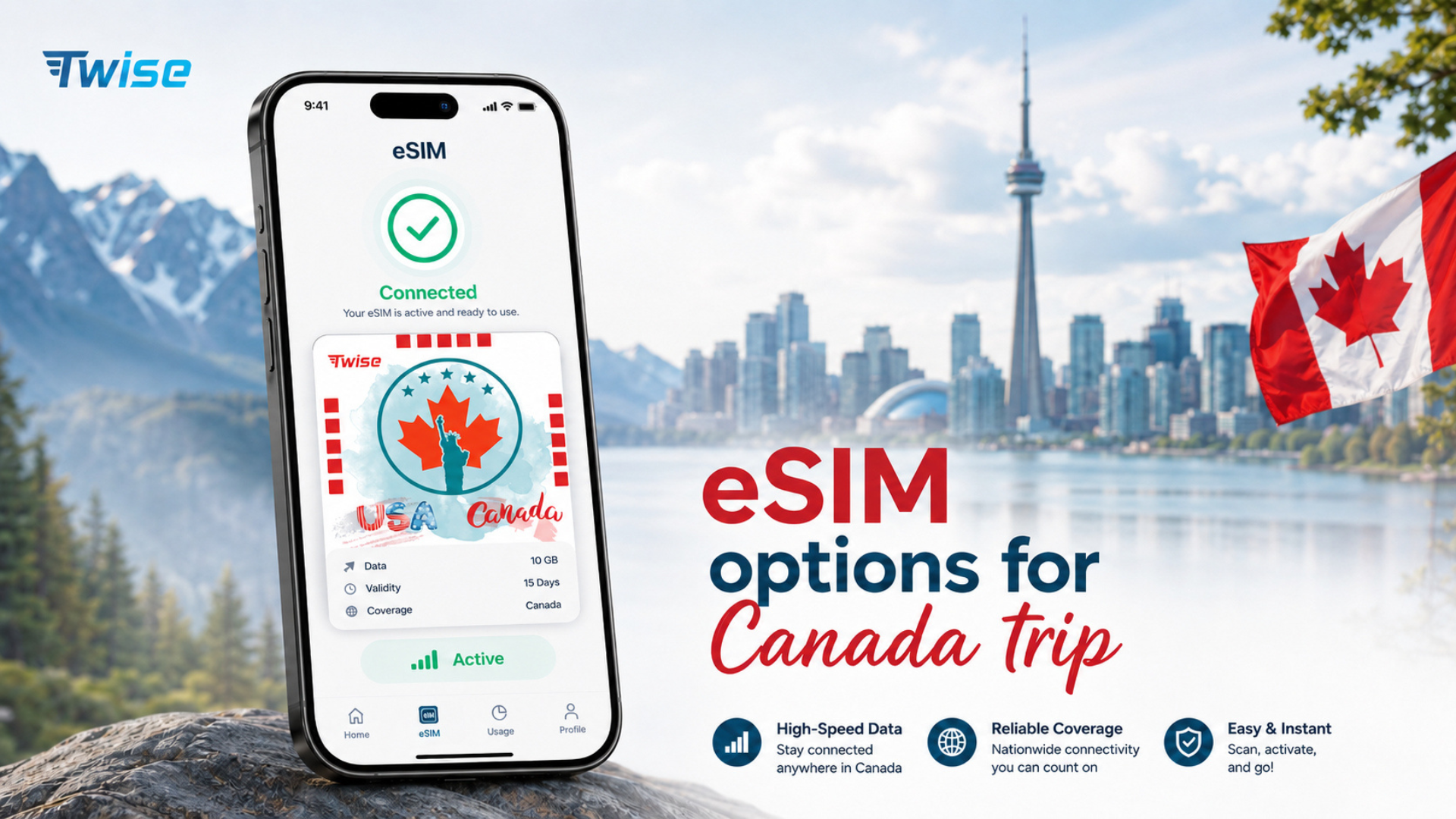
Twise eSIM fits naturally into this Canada travel app setup because most travel apps are only useful when they are current. Offline downloads help you prepare, but live data keeps maps, transit, weather, ride-hailing and hotel communication working when plans change.
Why travel apps need data after landing
Many travel apps are dynamic. Maps need current traffic. Transit apps need real-time arrivals and service alerts. WeatherCAN needs fresh alerts. Ride-hailing needs driver communication. Hotel apps need messages and check-in updates. A travel eSIM helps keep these functions available without relying only on airport Wi-Fi or expensive roaming.
Twise positioning
Twise eSIM is useful for travelers who want mobile data ready for maps, transit, weather alerts, hotel messages, ride-hailing, road changes and emergency searches after landing in Canada. The message should stay practical: Twise does not replace offline preparation, it completes it by keeping key apps live.
Pair eSIM with offline downloads
The strongest recommendation is to use both: download offline maps, park guides and travel confirmations on Wi-Fi before departure, then activate or prepare your Canada eSIM so live updates work after arrival. This gives travelers a backup when signal is weak and current information when the internet is available.
Internal link placement
- Canada eSIM page: place after the Twise positioning paragraph and in the final checklist.
- General eSIM page: link when explaining how eSIM helps travel apps work after landing.
- eSIM-compatible devices guide: link in the checklist item “Check eSIM compatibility.”
- How to place/install a Twise eSIM: link near the setup recommendation.
- Data-saving guide or data calculator: link in the offline downloads vs mobile data section if available.
10-Minute Canada App Setup Checklist Before Departure
Use this checklist before your flight so the essential app for traveling to Canada is already ready when you land.
- Install ArriveCAN and check whether Advance CBSA Declaration applies to your arrival airport.
- Submit Advance CBSA Declaration if eligible and within the correct time window.
- Install your airline app and enable flight notifications.
- Download Google Maps or Apple Maps offline for your arrival city and hotel area.
- Install Transit or local transit apps for the Canadian cities on your itinerary.
- Install WeatherCAN and enable alerts for your current location and saved destinations.
- Install Parks Canada if visiting national parks or historic sites.
- Download trail maps if hiking or visiting remote outdoor areas.
- Save your hotel address, check-in details and booking confirmation offline.
- Add payment cards to your phone wallet and confirm your bank app works.
- Install ride-hailing apps if available in your arrival city.
- Check whether your phone supports eSIM.
- Install or prepare your Twise Canada eSIM if timing allows.
- Save emergency contacts and travel insurance information offline.
- Turn off automatic app updates over mobile data.
- Pack a power bank for arrival, winter travel and outdoor days.
Final Decision Guide: Which Canada Travel Apps Do You Really Need?
You do not need every app in this article. Choose the right setup based on your itinerary, transport style and season.
If you are only visiting cities
Use ArriveCAN, Google Maps or Apple Maps, Transit or local transit apps, WeatherCAN, your hotel app, your airline app and Twise eSIM. This is enough for most first-time visitors staying in Toronto, Vancouver, Montreal, Ottawa or Calgary.
If you are road-tripping
Add offline map regions, GasBuddy, your car rental app, road/weather tools and EV charging apps if renting an electric vehicle. Keep mobile data available for closures, traffic, fuel searches and accommodation messages.
If you are visiting national parks
Add Parks Canada, WeatherCAN, Google Maps offline and an offline trail app such as AllTrails or Avenza. Download maps and booking details before entering weak-signal areas.
If you are traveling in winter
Prioritize WeatherCAN, airline notifications, transit alerts, road condition tools, offline maps and a power bank. Winter travel depends on current information more than summer city travel does.
If you want fewer apps
Use the minimum stack: ArriveCAN, Google Maps, WeatherCAN, your airline app, your hotel app and Twise eSIM setup. Add Transit if you will use public transport often, and add Parks Canada if you will visit national parks.

FAQs About Apps for Traveling to Canada
About Twise eSIM
About Twise eSIM
If ArriveCAN, Google Maps, Transit, WeatherCAN, Parks Canada, ride-hailing, or hotel access are part of your Canada trip, reliable mobile data matters from the moment you land.
Twise offers travel eSIM plans designed to keep essential apps working beyond airport Wi-Fi. For travelers using maps, transit alerts, weather updates, hotel messages, ride-hailing, and emergency searches in Canada, having mobile data ready after arrival can make the first hours of the trip smoother and less stressful.
Current Twise eSIM options:
- Canada eSIM – suitable for travelers who need mobile data for maps, transit apps, weather alerts, hotel access, ride-hailing, and daily travel searches across Canada.
- USA local eSIM – T-Mobile or AT&T network, includes calls and SMS, suitable for road trips, rental cars, and travelers who need a local number in the US.
- Europe eSIM – covers major European destinations with calls and SMS included.
- Japan local eSIM – local carrier network for train-heavy travel, map apps, and city navigation.
- South Korea local eSIM – local network access with strong urban and transit coverage.
Almost all plans are installed digitally. No physical SIM, no store visit, no deposit or return process.
For Canada travel specifically: offline maps and saved booking details are useful, but they cannot replace live data for weather alerts, transit disruptions, ride-hailing, hotel messages, road changes, or emergency searches. Most travelers do not need unlimited data just for Google Maps, but if you use live navigation all day, ride-hailing often, translation, video calls, or hotspot sharing, check the plan’s data size and hotspot policy before purchasing.
